- Joined
- Sep 21, 2004
- Messages
- 1,710
- Reaction score
- 51
Here are some shots from today of Texoma. We have had so much rain this year that everything is starting to flood. The lake is at its highest elevation in over 10 years and is suppose to keep rising. The photo's have been cropped and that is about it. They were all shot out of the truck, didn't have time to set up tri-pod.
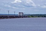
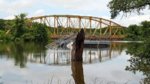
The Rosevelt bridge
[attachment=42821:attachment]
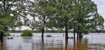
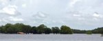
The camp ground I stayed at a few weeks ago in Catfish Bay
[attachment=42822:attachment]
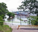
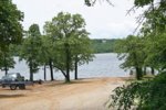
One of the launch ramps still open
[attachment=42823:attachment]
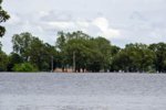
Another shot of the camp ground
[attachment=42824:attachment]
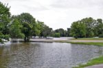
The Rooster Creek Camp Ground
[attachment=42825:attachment]
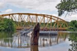
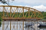
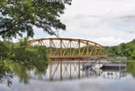
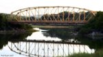
Rooster Creek bridge
[attachment=42826:attachment]
[attachment=42827:attachment]
[attachment=42828:attachment]
[attachment=42829:attachment]
Here is the normal water elevation at the rooster creek brige. Just a little insight on how much rain we have had.
[attachment=42830:attachment]
The Rosevelt bridge
[attachment=42821:attachment]
The camp ground I stayed at a few weeks ago in Catfish Bay
[attachment=42822:attachment]
One of the launch ramps still open
[attachment=42823:attachment]
Another shot of the camp ground
[attachment=42824:attachment]
The Rooster Creek Camp Ground
[attachment=42825:attachment]
Rooster Creek bridge
[attachment=42826:attachment]
[attachment=42827:attachment]
[attachment=42828:attachment]
[attachment=42829:attachment]
Here is the normal water elevation at the rooster creek brige. Just a little insight on how much rain we have had.
[attachment=42830:attachment]
Attachments
-
 Bridge.jpg42.3 KB · Views: 2
 -
 Camp_Ground.jpg62.3 KB · Views: 2
 -
 Launch_Ramp.jpg101.4 KB · Views: 1
 -
 Point.jpg40.4 KB · Views: 22
 -
 RC_Camp.jpg79.2 KB · Views: 1
 -
 Rooster_creek.jpg62.4 KB · Views: 4
 -
 Rooster_creek1.jpg89 KB · Views: 1
 -
 Rooster_Creek2.jpg89.5 KB · Views: 1
 -
 Rooster_Creek3.jpg75.2 KB · Views: 2
 -
 bridge1.jpg101.1 KB · Views: 13